Products
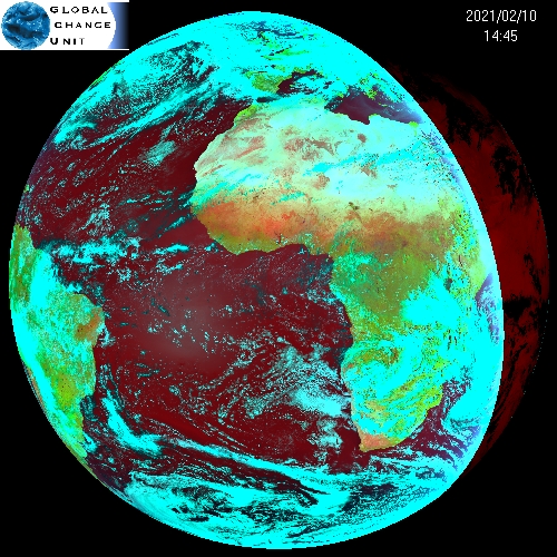
SEVIRI
Our SEVIRI products cover half the surface of the Earth, including Europe, Africa, the Arabic Peninsula and part of South America. The amount of data acquired and processed by UCG/IPL since July 2007 includes several hundred thousand images (five terabytes per year). SEVIRI products distributed in this system are at the moment:
- NDVI (Normalized Difference Vegetation Index), every 15 minutes,
- SLST (Sea and Land Surface Temperature), every 15 minutes.
Static ancillary data for MSG-SEVIRI sensor (Longitude, Latitude, Viewing Azimuth Angle - VAA, Viewing Zenith Angle - VZA) are available for download here.
Details of the processing scheme and of the selected algorithms can be found in:
Julien, Y., Sobrino, J. A. & Sòria, G. (2015). Retrieving and broadcasting near-real time biophysical parameters from MODIS and SEVIRI receiving stations at the Global Change Unit of the University of Valencia, International Journal of Remote Sensing, DOI:10.1080/01431161.2015.1040134.
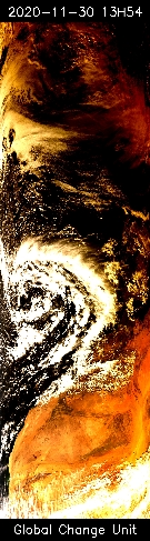
MODIS
Our MODIS products cover most of Western Europe and Northwestern Africa. The amount of data acquired and processed by UCG/IPL since July 2010 rounds ten thousand images (more than one terabyte of data). MODIS products distributed in this system are at the moment:
- Ancillary data: longitude, latitude, viewing and solar zenith and azimuth angles,
- Masks: land/sea, day/night, snow and cloud masks,
- NDVI (Normalized Difference Vegetation Index),
- Emissivity (for thermal infrared wavelengths),
- Atmospherically corrected reflectances,
- Total amount of atmospheric water vapor,
- SLST (Sea and Land Surface Temperature).
All these products are available for each MODIS overpass of our station (around 6 per day).
Details of the processing scheme and of the selected algorithms can be found in:
Julien, Y., Sobrino, J. A. & Sòria, G. (2015). Retrieving and broadcasting near-real time biophysical parameters from MODIS and SEVIRI receiving stations at the Global Change Unit of the University of Valencia, International Journal of Remote Sensing, DOI:10.1080/01431161.2015.1040134.
VIIRS
Our VIIRS products also cover most of Western Europe and Northwestern Africa. The amount of data is acquired and processed by UCG/IPL since January 2108. VIIRS products distributed in this system are at the moment:
- Ancillary data: longitude, latitude, viewing and solar zenith and azimuth angles,
- Masks: land/sea, day/night, snow and cloud masks,
- NDVI (Normalized Difference Vegetation Index),
- Emissivity (for thermal infrared wavelengths),
- Total amount of atmospheric water vapor,
- SLST (Sea and Land Surface Temperature).
All these products are available for each VIIRS overpass of our station (0 to 4 per day).